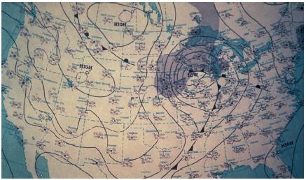
An Isobar is a line on a graph, chart, or map that has the same pressure. These are lines drawn on a map to connect places with equal average atmospheric pressures. In this example the reader can see where each part of the country is sharing the same level of pressure. The midwest storm appears to be holding over the great lakes region, but it is affecting the entire United States as well as Canada and Mexico.
Isobar map


No comments:
Post a Comment